15-112: placeHolder (2020)
A wide variety of Photogrammetry technology exists today. They take a series of images and reconstruct a 3D form based on the content of the images. This project situates itself amongst these, allowing the user to generate a 3D model from 360-degree images through online databases. Much other software including Autodesk Recap, Multi-view environment, and Meshroom all serve to generate geometry from image distances. In fact, human’s perception of space uses the same underlying logic as all these programs. The slight differences in images sent to our brain from our eyes tells us what is near and what is far.
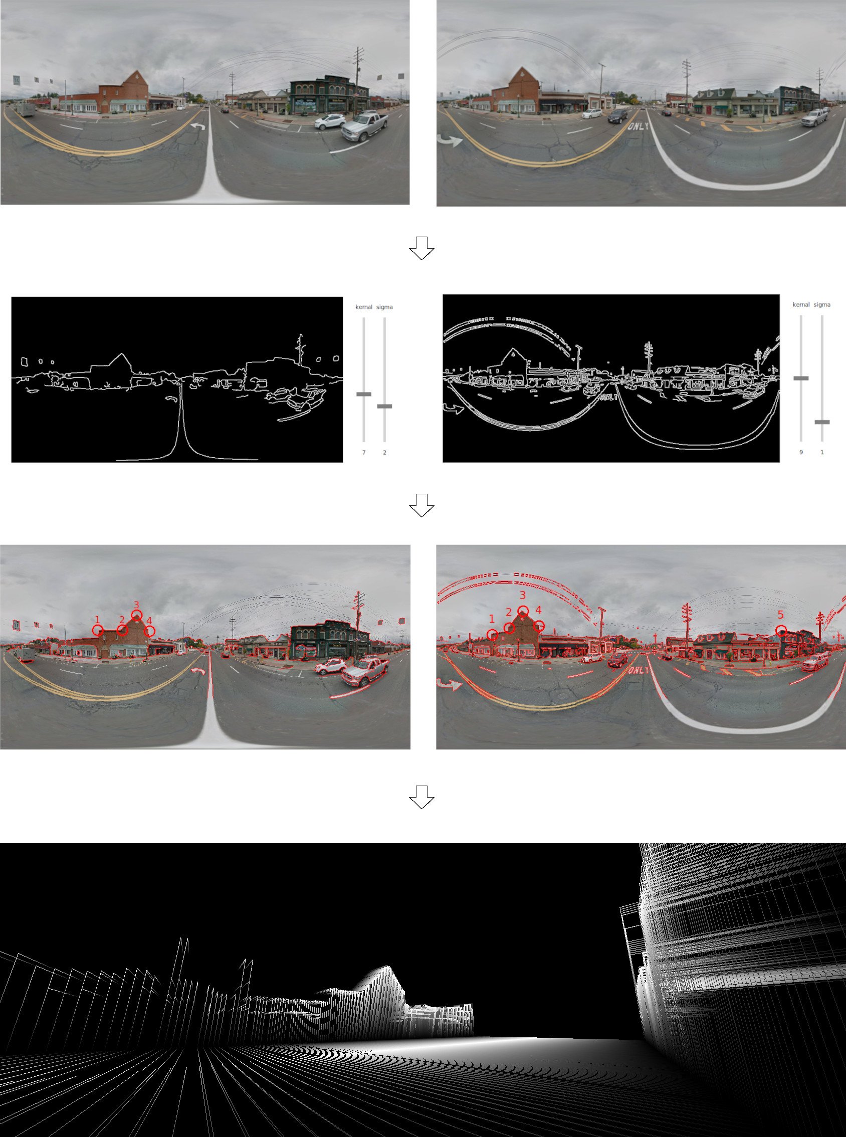
The project, titled placeHolder, was an exploration of photogrammetric techniques written from-scratch with Python. It is an inquiry into quick generation of site geometry (buildings, roads, etc.) for use in site mapping and architectural design. First, the user selects two 360-degree panoramic images either from google maps or elsewhere. Then, placeMaker interprets the selected images and detects edges. Finally, the program cross-references the images to place them in 3D space and allows the user to fly through and examine the projected geometry.
- 2025
- Primitive Slicer
- 2024
- Semantic Floor Plans
- ITECH Research Pavilion
- Wax Flamingos
- Phenomena Modeling
- 2023
- Honeycomb
- Water-QWOP
- Horse & Chariot
- Hyper-hydration
- 2022
- Sprawl & Resilience
- 2021
- Cybernetic Field
- Bubble-GAN
- 2020
- ELC: Carrick
- 15-112: placeHolder
- Collaborative Winding
- 2019
- Flood Museum
- Design Fabrication
- Spring Garden Hostel
- Modular Garden
- Bathhouse
- 2018
- Hoophouse
- Drawings